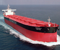
Case study for onboard safety meeting Gíounding due to GPS jamming

The vessel was nominated to call a port in the East Mediterranean region that was located within the Joint War Committee (JWC) listed areas. Despite being in an area with heightened security considerations, the port was operating under normal conditions and remained open to maritime trade. At around 2020 hours on 6 December, both GPS sets on the vessel triggered alarms and displayed inaccurate positions. Simultaneously, all bridge equipment linked to the GPS systems also raised alarms. In response, the Officer of the Watch (OOW) switched the ECDIS sensor setting to DR (Dead Reckoning) mode and continued navigating.
The vessel maintained its course toward the pilot station at full ahead.
The vessel was quite far from land, and as such a RADAR fix could not be taken. As an alternative, the OOW opted to reach out to the local navy to ascertain the vessel’s current position. As the vessel neared the port, RADAR fixes were acquired using range and bearing, and these were plotted on ECDIS through the RADAR overlay function. The vessel’s position was cross checked using the positions obtained from the local navy.
The Master was called at 2200 hours on 6 December. After arriving on bridge, the OOW briefed him on the malfunction of the GPS. The Master took over the con at 2230 hours, and soon thereafter the OOW stopped verifying vessel’s position with the local navy. Engines were tested and pre-arrival checks completed at 2300 hours on 6 December. The vessel maintained various courses and speeds thereon. Meanwhile, the alarms on all bridge equipment connected to the GPS kept on reappearing, and the crew were focused on acknowledging them each time they appeared.
Approximately 30 minutes before the scheduled pilot boarding time, the port control notified the vessel of a berthing delay and directed her to the anchorage. Unknown to the crew, the vessel’s actual position was approximately 2 nautical miles east of the position manually plotted on the ECDIS. The Master adjusted the course towards the anchorage with engines on half ahead. Soon thereafter the vessel ran aground on a reef at 8 knots. The vessel listed 5 degrees to starboard with no hull breach. As the vessel’s satellite phones and email communication were also non-functional, the shore management was contacted via the personal mobile phone of a crew member operating on a local SIM card. Additionally, Class was informed, and their emergency response service was activated. Salvors were engaged, and it took 48 hours for two tugs to successfully refloat the vessel.
Some of the observations noted during the investigation were:
•Shortly before the ship ran aground, the VTS alerted the vessel via VHF, cautioning that it was approaching the reef. Unfortunately, the crew missed the message because the VHF equipment was consistently sounding alarms, being connected to the GPS.
•GPS jamming was triggered by the local armed forces due to an ongoing conflict in the region. However, no navigational warning was transmitted to alert the vessels in advance. It was only after this incident that the port authority published a circular cautioning all vessels of GPS interference in the port waters.
•Recurring alarms on the bridge distracted the bridge watchkeepers. OOWs attention was therefore split between navigation and acknowledging the alarms. The Bridge Manning level remained the same inspite of the increased workload of the watchkeepers.
•This was the first time the bridge watchkeepers, including the Master, were calling this port.
How to impíove by lessons leaínt
You should now perform an onboard risk assessment of the operation described. Learning from the case could be obtained by identifying the contributing factors for this specific incident to occur – and discuss whether some of the identified factors could be present onboard your ship.
Key questions or points for bridge watchkeepers to discuss:
Crew training and familiarization
•Are they able to recognize a compromised GPS environment, such as jamming?
•Has the bridge team been trained in responding to such situations?
•Actions to be taken when the GPS signal is lost, or it malfunctions.
•Familiarity with alternative means of position fixing methods on ECDIS, such as visual or RADAR fixes, and how often do watchkeepers practice this.
Procedural
•Are there guidelines in the safety management system to identify and respond to a compromised GPS
environment?
•Does our passage plan appraisal include a voyage specific risk assessment that addresses the considerations of calling ports operating under heightened security risk levels?
•Is contingency plan for failure of GPS formulated and its effectiveness verified during drills or actual failure?
A few key words to facilitate discussion:
•automation bias
•con rmation bias
•human factors
•GPS malfunction
•alarm management
•bridge watch keeping level
•contingency planning
•position fixes.
Source: GARD, https://www.gard.no/Content/36804605/cache=20240503120815/Gard%20Case%20study%20%20Grounding%20due%20to%20GPS%20jamming.pdf

 Hellenic Shipping News Worldwide Hellenic Shipping News Worldwide, Online Daily Newspaper on Hellenic and International Shipping


 PG-Software